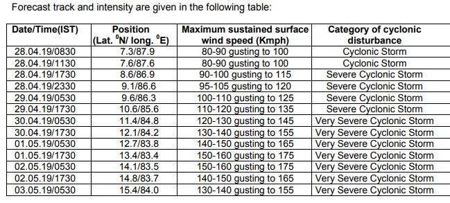
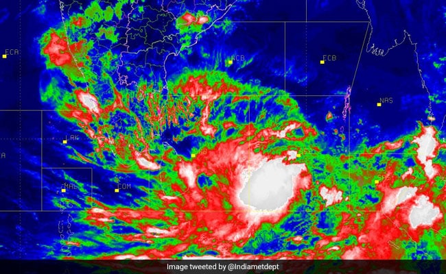
Cyclone Fani, which has been strengthening in south-east Bay of Bengal, is very likely to intensify into a severe cyclonic storm during the next 12 hours and into a very severe cyclonic storm during the subsequent 24 hours.
Fani is very likely to move northwestwards till May 1 and thereafter recurve towards northeast gradually.
"Cyclonic Storm ''FANI'' lay centred at 0530 hrs over southeast Bay of Bengal and neighbourhood, about 745 km east-southeast of Trincomalee (Sri Lanka), 1050 km southeast of Chennai (Tamil Nadu) and 1230 km south-southeast of Machilipatnam (Andhra Pradesh), a bulletin by the Indian Meterological Department (IMD) said.
The wind speed is likely to decrease gradually thereafter with gale wind speed reaching 130-140 kmph gusting to 150 kmph over west-central Bay of Bengal off Andhra Pradesh Coast on May 3.
Light to moderate rainfall at many places with heavy rains at isolated places are very likely over Kerala on April 29 and 30. Light to moderate rainfall is expected at few places over north coastal Tamil Nadu and coastal Andhra Pradesh on April 29 and 30, the IMD said. On Thursday, the IMD had issued a ''red alert'' for Tamil Nadu on April 30 and May 1.
Weather experts have predicted that Tamil Nadu coast, including Chennai, and Puducherry are likely to receive heavy rainfall from April 30 for three days. Kerala will also receive rainfall.
Here are the LIVE Updates on Cyclone Fani:

As predicted by Skymet Weather, the Cyclonic Storm #Fani is now all set to become more powerful as we can expect it to intensify into a Severe Cyclonic Storm by Sunday afternoon. #CycloneFani #Cyclone #TamilNadu https://t.co/2Gt9s0ry3k
- SkymetWeather (@SkymetWeather) April 28, 2019
Cyclone Fani, which has been strengthening in south-east Bay of Bengal, is very likely to intensify into a severe cyclonic storm during the next 12 hours and into a very severe cyclonic storm during the subsequent 24 hours.


