Advertisement
6 years ago

The cyclonic storm 'Gaja' is set to make landfall in Tamil Nadu today. The cyclonic storm will hit the Tamil Nadu coast between Cuddalore and Pamban. 'Gaja' that lay over southwest and adjoining southeast and west central Bay of Bengal is about 480 km north east of Nagapattinam and is very likely to cross coast between Pamban and Cuddalore on Thursday evening or night with a wind speed gusting upto 100 kmph, the Met office said.

The state government has taken necessary measures to tackle Cyclone Gaja. Over 30,000 rescue personnel have been placed on standby; the district collectors of Thanjavur, Tiruvarur, Pudukottai, Nagapattinam, Cuddalore and Ramanathapuram have declared holiday for schools and colleges on Thursday. All educational institutions in Puducherry and Karaikal regions would remain closed today in view of the cyclone.

The National Disaster Response Force has placed eight teams in coastal areas.

Here are the LIVE updates on Cyclone Gaja:

Visuals from a relief camp in Tamil Nadu's Nagapattinam.
"Gaja Cyclone now lies at about 80 km southeast of Karaikal, moving at rate of 16 km per hour. It's expected to cross between Vedaranyam and Nagapattinam between 12 am to 3 am," MET official from Chennai Balachandran told news agency ANI. He added that the eye of the cyclone is expected to touch the land within the next hour.
Private weather monitor Skymet said that rains have hit many parts of Ariyalur, Tiruvarur, Pudukkottai, Perambalur, Thanjavur and Cuddalore in Tamil Nadu. Gaja Cyclone is around 60 kms from the coast, Skymet added.
Private weather forecaster Skymet Weather said that Cyclone Gaja is around 80 kms from the Tamil Nadu coast. The outer ring of clouds is now covering coast, Skymet said.

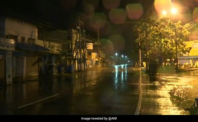
Visuals of rainfall from Nagapattinam in Tamil Nadu. Cyclone Gaja is expected to make a landfall tonight.
Private weather monitoring agency Skymet has predicted light rains over Chennai. "Heavy rains are ruled out for Chennai. You will have a pleasant weather," Skymet Weather said on Twitter.
Private weather monitoring agency Skymet said that the landfall of Cyclone Gaja is expected between midnight and 1 am tonight. The torrential rains and force winds are expected to hit Nagappattinam, Thanjavur, Tiruvarur, Ariyalur and Pudukkottai districts of Tamil Nadu.
The outer band of the cyclone has entered the land area near Nagapattinam, nearly 300 km from state capital Chennai. 

The state government says it is adequately prepared. More than 6000 relief camps have been opened and eight rescue teams have been put in place.
Around 12,000 people have been evacuated from coastal Tamil Nadu ahead of cyclone Gaja's landfall. Around 10,692 people are from Nagapattinam district where the landfall is expected to happen.

"The outer band of severe cyclonic storm Gaja has entered the land area," said MeT Director in Chennai Dr S Balachandran. "It still remains a severe cyclonic storm. It would take three to four hours for the eye of the cyclonic storm to make landfall."
According to the India Meteorological Department, the severe cyclonic storm Gaja over Southwest Bay of Bengal moved further west-southwestwards with a speed of 22 kmph during past 6 hours and lay centred at 11:30am over Southwest Bay of Bengal, about 280 km southeast of Chennai and 240 km east-northeast of Nagapattinam.
According to Skymet Weather Services Pvt, Cyclone Gaja to weaken before landfall over Tamil Nadu.
Skymet Weather Services Pvt says Cyclone Gaja is expected to cross Tamil Nadu coast shortly. It has advised people to avoid venturing out in the sea.
Visuals of heavy rainfall from Cuddalore:

Cuddalore MLA MC Sambath has held a review meeting with Collector V. Anbuselvan and Disaster Managment Incharge Gagandeep Singh Bedi along with rescue teams here.

"It is expected that Gaja cyclone will make landfall late tonight, maybe in south of Cuddalore in Nagapattinam district. People should be well prepared. The government is making its best efforts in this regard," Mr Bedi said.
In its Thursday bulletin, the IMD said the cyclone moved at 14 kmph and lay centred over east-northeast of Nagapattinam at 5.30 a.m. 

Gaja is likely to move west-southwestwards and cross between Pamban and Cuddalore.

The sea condition is very likely to be rough to very rough along and off Tamil Nadu-south Andhra Pradesh and Puducherry coasts Thursday afternoon onwards, the IMD said.
The Met department said it would intensify this afternoon and weaken before making a landfall.
Two Naval ships Ranvir and Khanjar are on standby to proceed to undertake Humanitarian Aid Distress Relief, evacuation, logistic support&medical aid.Ships will be embarked with additional divers,doctors, inflatable rubber boats,integral helicopters and relief material.
The district collectors of Thanjavur, Tiruvarur, Pudukottai, Nagapattinam, Cuddalore and Ramanathapuram have declared holiday for schools and colleges today.
6,000 relief centres have been set up across the state. 10 NDRF teams are on stand by.
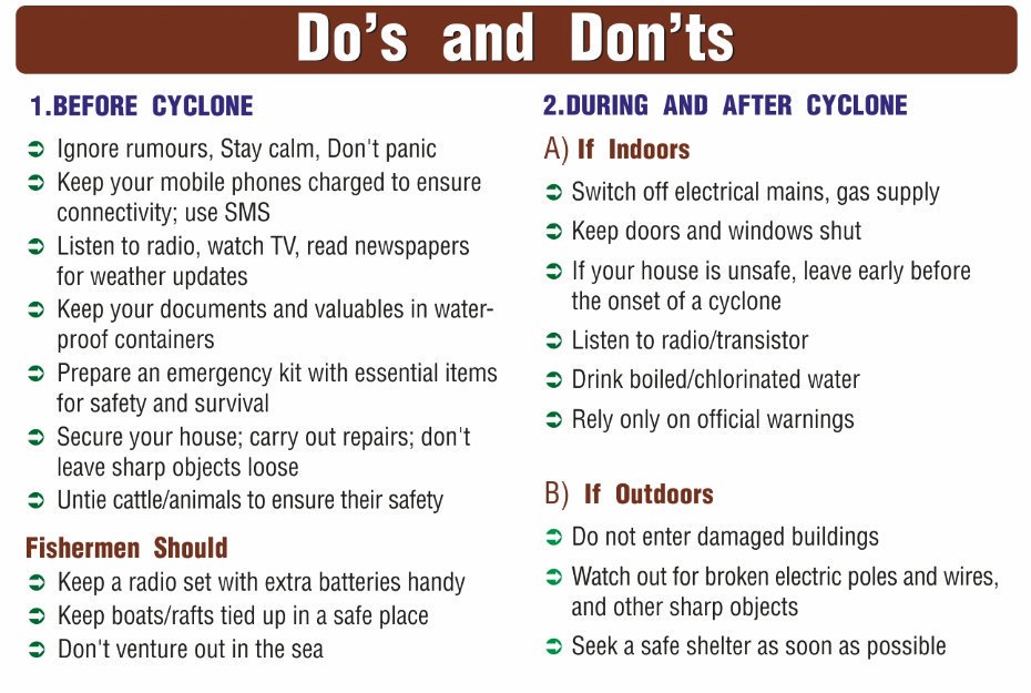
Here's how you can stay safe during Cyclone Gaja
The National Disaster Management Authority has issued safety precautions to handle the effects of the cyclone.


The Cyclone is expected to reach wind speeds of 90 KM an hour. Schools and colleges in five districts have been closed as a precautionary measure.
Gaja cyclone is expected to make landfall between Pamban and Cuddalore.The cyclone, MET officials say, would first intensify into a severe cyclone this afternoon and weaken  into a cyclonic storm before landfall.

Track Latest News Live on NDTV.com and get news updates from India and around the world

Follow us:
Listen to the latest songs, only on JioSaavn.com