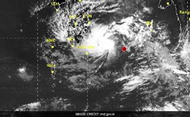
A cyclonic storm named Nada has been building up in the Bay of Bengal and is expected to cross the Tamil Nadu coast on Friday, December 2, the Met department has said. It is expected make landfall close to Cuddalore, around 185 km from Chennai, between Vedaranyam in Tamil Nadu and Puducherry, it said. Currently, the cyclone is about 710 km south-east of the Tamil Nadu capital and is expected to move west and intensify. The entire south-east coast can expect heavy to moderate showers accompanied by strong winds as the depression in the Bay of Bengal nears the eastern coast.
Here are 10 things to know about Cyclone Nada:
In the next 24 hours, Tamil Nadu will receive rains along the coastal parts and then it will gradually move to the inner districts.
Squalls between 45 kmph to 65 kmph would commence from December 1.
Chennai is expected to receive moderate rain from Wednesday night and heavy rainfall has been forecast in the northern coastal areas of Tamil Nadu and Puducherry from Thursday.
In Chennai, the rains are expected to intensify gradually as the cyclone edges closer to the coast, S Balachandran, director of the Area Cyclone Warning Centre said.
Schools in Tamil Nadu's Cuddalore and Nagapattinam districts, and Puducherry will remain closed for the next two days.
Puducherry Chief Minister V Narayanasamy has instructed the district administration and the chief secretary to be "on full alert".
"We have put flags along the coastline and de-silted the drains to avoid flooding in the heavy rain," the Puducherry chief minister has said.
National Disaster Management Authority (NDMA) member Lt General N C Marwah reviewed the preparedness of Tamil Nadu and Puducherry to withstand the impact of the storm.
The weather department has also warned fishermen not to venture into the sea.
Light to moderate rainfall is also forecast in Kerala, with some places in the state receiving heavy rain on Friday.
(With inputs from Agencies)


