High Resolution Satellite
- All
- News
- Videos
-

Satellite Images Show Devastation From Landslides In Kerala's Wayanad
- Thursday August 1, 2024
- India News | Written by Pallava Bagla
High resolution images taken by Indian satellites show the widespread damage and devastation caused by landslides in Kerala's Wayanad. More than 150 people have died and over 200 injured even as the rescue works are ongoing.
-
 www.ndtv.com
-

China Counters India's Rafale With Stealth Jet Deployment Near Sikkim
- Friday May 31, 2024
- India News | Written by Vishnu Som
New, high resolution satellite imagery available with NDTV show several J-20s, China's most advanced stealth fighter, landing at a key high-altitude Tibetan air base located less than 150 kilometres from the Sikkim border.
-
 www.ndtv.com
-

Exclusive: Chinese Submarine, Warships In Karachi - What It Means For India
- Monday November 13, 2023
- India News | Written by Vishnu Som
High resolution satellite images accessed by NDTV indicate the presence of several frontline Chinese warships, a submarine and fleet support ships docked at Karachi harbour as Beijing and Islamabad kick off their largest ever Naval exercises.
-
 www.ndtv.com
-

Satellite Pics Show 500 Oil Tankers Destroyed On Afghanistan-Iran Border
- Thursday February 18, 2021
- World News | Written by Vishnu Som
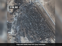
High resolution satellite imagery shows the impact of a massive fire that engulfed hundreds of trucks on February 13 at Afghanistan's Islam Qala, a key border crossing between Afghanistan and Iran's Herat province. At least 60 people were injured, news agency AFP reported.
-
 www.ndtv.com
-

Satellite Pics Show "Dangerous" Lake Formed By Uttarakhand Avalanche
- Friday February 12, 2021
- India News | Reported by Vishnu Som, Edited by Deepshikha Ghosh
High resolution satellite images have identified the exact spot where a "dangerous" lake was formed by the debris of the avalanche that left dozens dead and 200 missing on Sunday. Scientists of the Defence Research and Development Organisation(DRDO), the National Disaster Response Force (NDRF) and others are working on a plan to avoid another disas...
-
 www.ndtv.com
-

New Satellite Images Show Uttarakhand Avalanche's Path Of Destruction
- Tuesday February 9, 2021
- India News | Reported by Vishnu Som, Edited by Deepshikha Ghosh
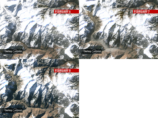
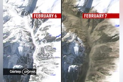
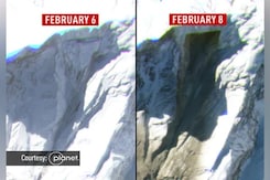
High resolution images available with NDTV indicate the clearest ever sequence of events leading up to the glacier burst in Uttarakhand's Chamoli on Sunday, which left 30 dead and over 170 missing.
-
 www.ndtv.com
-

Exclusive: Satellite Images Hint At Renewed China Threat In Doklam
- Sunday November 22, 2020
- India News | Written by Vishnu Som
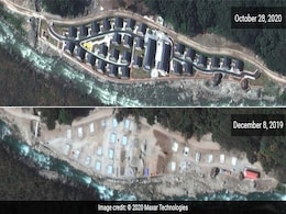
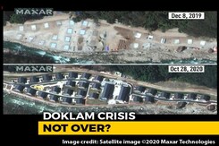
High resolution satellite imagery accessed by NDTV indicates that in addition to setting up a village more than two kilometres within Bhutanese territory on the eastern periphery of the contested Doklam plateau, China has built a road in the same area that stretches approximately 9 kilometres inside Bhutanese territory.
-
 www.ndtv.com
-

Partial Chinese Withdrawal From Fingers Area Along Pangong Lake: Satellite Pics
- Saturday July 11, 2020
- India News | Written by Vishnu Som
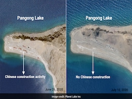
New, high resolution satellite images from July 10, now available with NDTV, show a distinct thinning out of Chinese positions in the contested Finger 4 area along the banks of Pangong Lake in Ladakh. Previous images showed construction activity in this region. However, hundreds of Chinese structures, including tents and sheds remain visible across...
-
 www.ndtv.com
-

Chinese Troops Withdraw 2 km In Galwan Valley, Show New Satellite Images
- Wednesday July 8, 2020
- India News | Reported by Vishnu Som, Edited by Anindita Sanyal
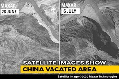
The Chinese soldiers' two-km withdrawal as part of the disengagement procedure in Ladakh has been backed up by high resolution satellite images from the bend of the Galwan river as it crosses the Line of Actual Control and flows into territory held by India in Ladakh. The disengagement process had started after Sunday's Special Representative-level...
-
 www.ndtv.com
-

Chinese Structures, Soldiers Spotted In Galwan Valley In New Satellite Images
- Wednesday June 24, 2020
- India News | Written by Vishnu Som
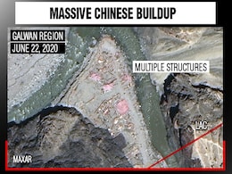
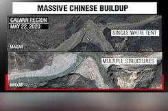
A day after India and China agreed to start the process of disengagement along the Line of Actual Control (LAC) in Ladakh, high resolution satellite images appear to show the presence of Chinese structures on both sides of the Line of Actual Control in the Galwan river valley.
-
 www.ndtv.com
-

Chinese Bring In Bulldozers, Disturb Flow Of Galwan River: Satellite Pics
- Friday June 19, 2020
- India News | Written by Vishnu Som
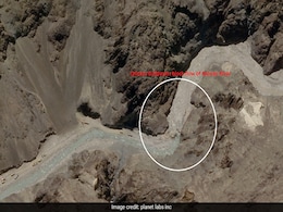
High resolution satellite images procured by NDTV indicate Chinese efforts to block or disturb the flow of the Galwan river in Northeast Ladakh, less than a kilometer from the site of the deadly clash between Indian and Chinese soldiers on June 15 in which 20 Indian officers and men were killed.
-
 www.ndtv.com
-

Exclusive: What Unreleased Satellite Images Of The Balakot Strikes Show
- Wednesday March 13, 2019
- India News | Written by Vishnu Som
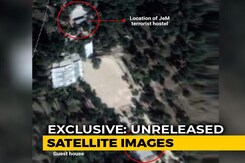
One of the images of the Indian Air Force (IAF)'s strike on the Jaish e Mohammed terror training camp in Pakistan's Balakot, seen by NDTV, is a monochrome high resolution photo.
-
 www.ndtv.com
-

The Kumbh Mela, As Seen From Space
- Thursday January 17, 2019
- India News | Written by Pallava Bagla
The world's largest religious gathering, Kumbh Mela, was captured from space by India's high resolution earth imaging satellite CartoSat-2.
-
 www.ndtv.com
-

Lifting Off Heaviest Ever Indian Satellite Is ISRO's Next Big Mission On December 5
- Friday November 30, 2018
- India News | Edited by Jayanth Jacob
Another spectacular feat beckons India's space research agency, ISRO-- less than a week from it launching country's best-ever high resolution satellite today.
-
 www.ndtv.com
-

Delhi Government Submits Satellite Images Of Sainik Farms In Delhi High Court
- Friday November 18, 2016
- Delhi News | Press Trust of India
The AAP government today placed before the Delhi High Court high resolution satellite images of Sainik Farms for the years of 2011, 2014 and 2015 to enable the court to find out if any unauthorised constructions took place there during the period from 2007 to 2016.
-
 www.ndtv.com
-

Satellite Images Show Devastation From Landslides In Kerala's Wayanad
- Thursday August 1, 2024
- India News | Written by Pallava Bagla
High resolution images taken by Indian satellites show the widespread damage and devastation caused by landslides in Kerala's Wayanad. More than 150 people have died and over 200 injured even as the rescue works are ongoing.
-
 www.ndtv.com
-

China Counters India's Rafale With Stealth Jet Deployment Near Sikkim
- Friday May 31, 2024
- India News | Written by Vishnu Som
New, high resolution satellite imagery available with NDTV show several J-20s, China's most advanced stealth fighter, landing at a key high-altitude Tibetan air base located less than 150 kilometres from the Sikkim border.
-
 www.ndtv.com
-

Exclusive: Chinese Submarine, Warships In Karachi - What It Means For India
- Monday November 13, 2023
- India News | Written by Vishnu Som
High resolution satellite images accessed by NDTV indicate the presence of several frontline Chinese warships, a submarine and fleet support ships docked at Karachi harbour as Beijing and Islamabad kick off their largest ever Naval exercises.
-
 www.ndtv.com
-

Satellite Pics Show 500 Oil Tankers Destroyed On Afghanistan-Iran Border
- Thursday February 18, 2021
- World News | Written by Vishnu Som
High resolution satellite imagery shows the impact of a massive fire that engulfed hundreds of trucks on February 13 at Afghanistan's Islam Qala, a key border crossing between Afghanistan and Iran's Herat province. At least 60 people were injured, news agency AFP reported.
-
 www.ndtv.com
-

Satellite Pics Show "Dangerous" Lake Formed By Uttarakhand Avalanche
- Friday February 12, 2021
- India News | Reported by Vishnu Som, Edited by Deepshikha Ghosh
High resolution satellite images have identified the exact spot where a "dangerous" lake was formed by the debris of the avalanche that left dozens dead and 200 missing on Sunday. Scientists of the Defence Research and Development Organisation(DRDO), the National Disaster Response Force (NDRF) and others are working on a plan to avoid another disas...
-
 www.ndtv.com
-

New Satellite Images Show Uttarakhand Avalanche's Path Of Destruction
- Tuesday February 9, 2021
- India News | Reported by Vishnu Som, Edited by Deepshikha Ghosh
High resolution images available with NDTV indicate the clearest ever sequence of events leading up to the glacier burst in Uttarakhand's Chamoli on Sunday, which left 30 dead and over 170 missing.
-
 www.ndtv.com
-

Exclusive: Satellite Images Hint At Renewed China Threat In Doklam
- Sunday November 22, 2020
- India News | Written by Vishnu Som
High resolution satellite imagery accessed by NDTV indicates that in addition to setting up a village more than two kilometres within Bhutanese territory on the eastern periphery of the contested Doklam plateau, China has built a road in the same area that stretches approximately 9 kilometres inside Bhutanese territory.
-
 www.ndtv.com
-

Partial Chinese Withdrawal From Fingers Area Along Pangong Lake: Satellite Pics
- Saturday July 11, 2020
- India News | Written by Vishnu Som
New, high resolution satellite images from July 10, now available with NDTV, show a distinct thinning out of Chinese positions in the contested Finger 4 area along the banks of Pangong Lake in Ladakh. Previous images showed construction activity in this region. However, hundreds of Chinese structures, including tents and sheds remain visible across...
-
 www.ndtv.com
-

Chinese Troops Withdraw 2 km In Galwan Valley, Show New Satellite Images
- Wednesday July 8, 2020
- India News | Reported by Vishnu Som, Edited by Anindita Sanyal
The Chinese soldiers' two-km withdrawal as part of the disengagement procedure in Ladakh has been backed up by high resolution satellite images from the bend of the Galwan river as it crosses the Line of Actual Control and flows into territory held by India in Ladakh. The disengagement process had started after Sunday's Special Representative-level...
-
 www.ndtv.com
-

Chinese Structures, Soldiers Spotted In Galwan Valley In New Satellite Images
- Wednesday June 24, 2020
- India News | Written by Vishnu Som
A day after India and China agreed to start the process of disengagement along the Line of Actual Control (LAC) in Ladakh, high resolution satellite images appear to show the presence of Chinese structures on both sides of the Line of Actual Control in the Galwan river valley.
-
 www.ndtv.com
-

Chinese Bring In Bulldozers, Disturb Flow Of Galwan River: Satellite Pics
- Friday June 19, 2020
- India News | Written by Vishnu Som
High resolution satellite images procured by NDTV indicate Chinese efforts to block or disturb the flow of the Galwan river in Northeast Ladakh, less than a kilometer from the site of the deadly clash between Indian and Chinese soldiers on June 15 in which 20 Indian officers and men were killed.
-
 www.ndtv.com
-

Exclusive: What Unreleased Satellite Images Of The Balakot Strikes Show
- Wednesday March 13, 2019
- India News | Written by Vishnu Som
One of the images of the Indian Air Force (IAF)'s strike on the Jaish e Mohammed terror training camp in Pakistan's Balakot, seen by NDTV, is a monochrome high resolution photo.
-
 www.ndtv.com
-

The Kumbh Mela, As Seen From Space
- Thursday January 17, 2019
- India News | Written by Pallava Bagla
The world's largest religious gathering, Kumbh Mela, was captured from space by India's high resolution earth imaging satellite CartoSat-2.
-
 www.ndtv.com
-

Lifting Off Heaviest Ever Indian Satellite Is ISRO's Next Big Mission On December 5
- Friday November 30, 2018
- India News | Edited by Jayanth Jacob
Another spectacular feat beckons India's space research agency, ISRO-- less than a week from it launching country's best-ever high resolution satellite today.
-
 www.ndtv.com
-

Delhi Government Submits Satellite Images Of Sainik Farms In Delhi High Court
- Friday November 18, 2016
- Delhi News | Press Trust of India
The AAP government today placed before the Delhi High Court high resolution satellite images of Sainik Farms for the years of 2011, 2014 and 2015 to enable the court to find out if any unauthorised constructions took place there during the period from 2007 to 2016.
-
 www.ndtv.com


