Mapping Drone
- All
- News
- Videos
-

Ancient Bronze Age Settlement Discovered in Caucasus Mountains Using Drone Mapping
- Thursday January 9, 2025
- Written by Gadgets 360 Staff
In the Caucasus Mountains, drone mapping has uncovered Dmanisis Gora, an ancient settlement dating back over 3,000 years. The project, led by Dr. Nathaniel Erb-Satullo and Dimitri Jachvliani, employed drones to capture high-resolution images of the site, revealing a vast defensive wall, graves, and other structural remains. The discovery challenges...
-
 www.gadgets360.com
-

Ukraine Rushes To Create AI-Enabled War Drones
- Thursday July 18, 2024
- Ai | Reuters
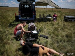
AI drone development in Ukraine is broadly split between visual systems helping identify targets and fly drones into them, terrain mapping for navigation, and more complex programmes enabling UAVs to operate in interconnected "swarms"
-
 www.ndtv.com
-

Manta Ray, Secret US Undersea Drone, Spotted On Google Maps, Later Removed
- Tuesday June 25, 2024
- World News | Edited by NDTV News Desk
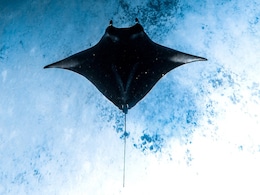
Manta Ray, a top-secret submarine prototype weapon of the US, was spotted by Google Maps docked at the Port Hueneme naval base in California on Sunday.
-
 www.ndtv.com
-

Drones Used To Map Antarctica To Monitor Effects Of Climate Change: Study
- Wednesday March 8, 2023
- Science | Press Trust of India
The drone-derived imagery is being used by researchers to evaluate the fragile ecosystem in Antarctica and changes in the extreme environment.
-
 www.ndtv.com
-

Centre Undertakes Series of Reform Measures to Make India Global Drone Hub by 2030, MoS Civil Aviation Says
- Monday August 1, 2022
- Press Trust of India
The government has taken various steps to make India a global drone hub by 2030, Minister of State for Civil Aviation VK Singh told the Rajya Sabha on Monday. The Centre has notified the Liberalised Drone Rules, 2021, and a PLI scheme for drones, published the Drone Airspace Map and UAS traffic management policy framework last year, among other mea...
-
 www.gadgets360.com
-

Watch: Big Leap In Tech, Drones Carry Water For Flood-Hit People In Assam
- Sunday June 26, 2022
- India News | Reported by Ratnadip Choudhury, Edited by Chandrajit Mitra
Drones are being used to carry out flood mapping and provide essentials in Assam's Silchar, in a game-changing use of technology that is making its mark in relief operations.
-
 www.ndtv.com
-

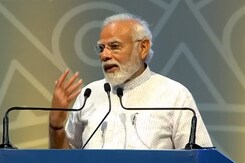
"Drones To Play Vital Role For Farmers": PM Modi At Drone Mahotsav
- Friday May 27, 2022
- India News | Asian News International
Highlighting the usage of drones in the country, Prime Minister Narendra Modi on Friday said that PM Svamitva Yojana has helped in the digital mapping of property in villages.
-
 www.ndtv.com
-

Drone Import Banned in India, Government Provides Certain Exceptions
- Thursday February 10, 2022
- Press Trust of India
India has banned import of foreign drones with certain exceptions as part of efforts to promote domestic manufacturing of drones in the country.
-
 www.gadgets360.com
-

Republic Day Parade To Showcase Old, New Era Of Army
- Sunday January 23, 2022
- India News | Asian News International
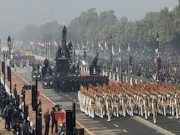
In the 75th year of Independence, the Republic Day parade would showcase the old and the new era of the Army in terms of uniforms and weapons used while the Beating Retreat ceremony would see the inclusion of a laser mapping and drone show.
-
 www.ndtv.com
-

Drones To Map Unsurveyed Areas Of Assam's Bodoland Territorial Region
- Wednesday December 29, 2021
- India News | Press Trust of India
Drones will be deployed to map unsurveyed inhabited areas in Bodoland Territorial Region as the exercise will enable authorities to modernise its land record system and provide documents to inhabitants for utilising the resource as a financial asset.
-
 www.ndtv.com
-

Aviation Ministry Releases India's Airspace Map For Drone Operations: Top Features & Different Zones
- Friday September 24, 2021
- Business | Edited by Prashun Talukdar
The government on Friday released Indias airspace map for drone operations under the collective vision of an 'Aatmanirbhar Bharat'. "The drone airspace map comes as a follow-through of the liberalized Drone Rules, 2021 released by the government on August 25, the PLI scheme for drones released on September 15 and the Geospatial Data Guidelines issu...
-
 www.ndtv.com/business
-

India To Draw Up Digital Map Using Drones, Artificial Intelligence
- Monday September 16, 2019
- India News | Press Trust of India
India has initiated a project to digitally map the country with a resolution of 10 centimetres, using drones and technologies such as Artificial Intelligence and big data, a senior government official said on Monday.
-
 www.ndtv.com
-

Government Forms Panels To Help Drone Technology Task Force
- Friday June 22, 2018
- India News | Press Trust of India
The government today announced the formation of three committees to help a task force set up in April to prepare a road map for implementing the drone technology in the country.
-
 www.ndtv.com
-

Ancient Bronze Age Settlement Discovered in Caucasus Mountains Using Drone Mapping
- Thursday January 9, 2025
- Written by Gadgets 360 Staff
In the Caucasus Mountains, drone mapping has uncovered Dmanisis Gora, an ancient settlement dating back over 3,000 years. The project, led by Dr. Nathaniel Erb-Satullo and Dimitri Jachvliani, employed drones to capture high-resolution images of the site, revealing a vast defensive wall, graves, and other structural remains. The discovery challenges...
-
 www.gadgets360.com
-

Ukraine Rushes To Create AI-Enabled War Drones
- Thursday July 18, 2024
- Ai | Reuters
AI drone development in Ukraine is broadly split between visual systems helping identify targets and fly drones into them, terrain mapping for navigation, and more complex programmes enabling UAVs to operate in interconnected "swarms"
-
 www.ndtv.com
-

Manta Ray, Secret US Undersea Drone, Spotted On Google Maps, Later Removed
- Tuesday June 25, 2024
- World News | Edited by NDTV News Desk
Manta Ray, a top-secret submarine prototype weapon of the US, was spotted by Google Maps docked at the Port Hueneme naval base in California on Sunday.
-
 www.ndtv.com
-

Drones Used To Map Antarctica To Monitor Effects Of Climate Change: Study
- Wednesday March 8, 2023
- Science | Press Trust of India
The drone-derived imagery is being used by researchers to evaluate the fragile ecosystem in Antarctica and changes in the extreme environment.
-
 www.ndtv.com
-

Centre Undertakes Series of Reform Measures to Make India Global Drone Hub by 2030, MoS Civil Aviation Says
- Monday August 1, 2022
- Press Trust of India
The government has taken various steps to make India a global drone hub by 2030, Minister of State for Civil Aviation VK Singh told the Rajya Sabha on Monday. The Centre has notified the Liberalised Drone Rules, 2021, and a PLI scheme for drones, published the Drone Airspace Map and UAS traffic management policy framework last year, among other mea...
-
 www.gadgets360.com
-

Watch: Big Leap In Tech, Drones Carry Water For Flood-Hit People In Assam
- Sunday June 26, 2022
- India News | Reported by Ratnadip Choudhury, Edited by Chandrajit Mitra
Drones are being used to carry out flood mapping and provide essentials in Assam's Silchar, in a game-changing use of technology that is making its mark in relief operations.
-
 www.ndtv.com
-

"Drones To Play Vital Role For Farmers": PM Modi At Drone Mahotsav
- Friday May 27, 2022
- India News | Asian News International
Highlighting the usage of drones in the country, Prime Minister Narendra Modi on Friday said that PM Svamitva Yojana has helped in the digital mapping of property in villages.
-
 www.ndtv.com
-

Drone Import Banned in India, Government Provides Certain Exceptions
- Thursday February 10, 2022
- Press Trust of India
India has banned import of foreign drones with certain exceptions as part of efforts to promote domestic manufacturing of drones in the country.
-
 www.gadgets360.com
-

Republic Day Parade To Showcase Old, New Era Of Army
- Sunday January 23, 2022
- India News | Asian News International
In the 75th year of Independence, the Republic Day parade would showcase the old and the new era of the Army in terms of uniforms and weapons used while the Beating Retreat ceremony would see the inclusion of a laser mapping and drone show.
-
 www.ndtv.com
-

Drones To Map Unsurveyed Areas Of Assam's Bodoland Territorial Region
- Wednesday December 29, 2021
- India News | Press Trust of India
Drones will be deployed to map unsurveyed inhabited areas in Bodoland Territorial Region as the exercise will enable authorities to modernise its land record system and provide documents to inhabitants for utilising the resource as a financial asset.
-
 www.ndtv.com
-

Aviation Ministry Releases India's Airspace Map For Drone Operations: Top Features & Different Zones
- Friday September 24, 2021
- Business | Edited by Prashun Talukdar
The government on Friday released Indias airspace map for drone operations under the collective vision of an 'Aatmanirbhar Bharat'. "The drone airspace map comes as a follow-through of the liberalized Drone Rules, 2021 released by the government on August 25, the PLI scheme for drones released on September 15 and the Geospatial Data Guidelines issu...
-
 www.ndtv.com/business
-

India To Draw Up Digital Map Using Drones, Artificial Intelligence
- Monday September 16, 2019
- India News | Press Trust of India
India has initiated a project to digitally map the country with a resolution of 10 centimetres, using drones and technologies such as Artificial Intelligence and big data, a senior government official said on Monday.
-
 www.ndtv.com
-

Government Forms Panels To Help Drone Technology Task Force
- Friday June 22, 2018
- India News | Press Trust of India
The government today announced the formation of three committees to help a task force set up in April to prepare a road map for implementing the drone technology in the country.
-
 www.ndtv.com


