Satellite Image
- All
- News
- Videos
-

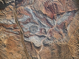
Iran’s Folded Rocks Reveal Ancient Tectonic Power at Asia-Europe Boundary
- Monday April 21, 2025
- Written by Gadgets 360 Staff
Iran’s Zagros Mountains showcase tightly folded rock layers caused by the slow-motion collision of the Arabian and Eurasian plates. Visible from space, these dramatic geological structures reveal the raw power of continental tectonics and provide scientists with valuable insights into mountain formation, seismic activity, and Earth’s ongoing st...
-
 www.gadgets360.com
-

ISRO Satellite Images Show Damage After Earthquake Rattled Myanmar
- Tuesday April 1, 2025
- World News | Written by Pallava Bagla
The Indian Space Research Organisation (ISRO) has released satellite images of the widespread damages caused by the 7.7 magnitude earthquake that struck Myanmar and rattled neighbouring countries on Friday.
-
 www.ndtv.com
-

Myanmar Earthquake Aftermath: Satellite Images Show Huge-Scale Destruction
- Monday March 31, 2025
- World News | Edited by Sanstuti Nath
The stench of decaying dead bodies permeated the air in Mandalay-- Myanmar's second-largest city-- on Sunday, two days after a massive earthquake killed at least 1,700 people and left countless others buried.
-
 www.ndtv.com
-

Satellite Images Show Fresh Chinese Bomber Deployment In South China Sea
- Friday March 28, 2025
- World News | Reuters
China deployed two long-range H-6 bombers around the Scarborough Shoal this week, in Beijing's latest move to assert sovereignty over the hotly disputed atoll in the South China Sea, satellite images obtained by Reuters showed.
-
 www.ndtv.com
-

Rocket Lab Deploys Eight Satellites to Boost Global Wildfire Monitoring
- Monday March 31, 2025
- Written by Gadgets 360 Staff
Rocket Lab successfully launched eight satellites into orbit for OroraTech on March 26. The mission, "Finding Hot Wildfires Near You," aims to improve real-time wildfire detection through thermal infrared imaging. The satellites will join OroraTech’s existing network, operating at a 97-degree inclination, 550 km above Earth. CEO Martin Langer hig...
-
 www.gadgets360.com
-

Partial Solar Eclipse of March 2025: Satellite Images to Show Moon’s Shadow
- Saturday March 29, 2025
- Written by Gadgets 360 Staff
A partial solar eclipse will take place on March 29, 2025, visible across parts of Europe, Africa, and North America. The event will reach its peak in Nunavik, Canada, where 94% of the sun will be covered at sunrise. From space, weather satellites like GOES-16 and Himawari will capture images of the moon’s shadow. The International Space Station ...
-
 www.gadgets360.com
-

NASA’s EZIE Satellites Begin Mission to Study Auroral Electrojets and Space Weather
- Friday March 21, 2025
- Written by Gadgets 360 Staff
NASA’s Electrojet Zeeman Imaging Explorer (EZIE) mission has been launched aboard a SpaceX Falcon 9 from Vandenberg Space Force Base. The trio of small satellites will map auroral electrojets, powerful currents in Earth’s atmosphere linked to solar storms. Their data will enhance space weather prediction models and help understand planetary mag...
-
 www.gadgets360.com
-

Google Pixel 9a Design, Colour Options Spotted in Leaked Renders and Marketing Images
- Saturday March 8, 2025
- Written by David Delima
Google Pixel 9a is expected to launch soon, and tipster Evan Blass has shared design renders showcasing the smartphone in four colour options, along with marketing images highlighting its features. Recently spotted on certification websites, the Pixel 9a is expected to be the next midrange smartphone from Google, equipped with the Tensor G4 chip us...
-
 www.gadgets360.com
-

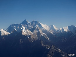
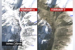
Mt Everest's Snow Cover Receded By 150 Metres This Winter, Show Satellite Images
- Thursday February 20, 2025
- World News | Press Trust of India
A 'rising snow line' -- in which snow melts at lower heights, forcing the snow line boundary up a mountainside -- is suggestive of a warming climate.
-
 www.ndtv.com
-

NASA’s PUNCH Mission Set to Track the Sun’s Corona and Solar Wind in 3D
- Friday February 7, 2025
- Written by Gadgets 360 Staff
NASA’s PUNCH mission, set for launch on Feb 27, will deploy four satellites to study the transition between the sun’s corona and the solar wind. The mission aims to improve understanding of space weather by capturing 3D images, helping predict solar storms with greater accuracy. The data will also complement NASA’s Parker Solar Probe, offerin...
-
 www.gadgets360.com
-

'Fireflies' Light Up Sky As India Gets 1st Private Satellite Constellation
- Wednesday January 15, 2025
- India News | Written by Pallava Bagla
A Bengaluru-based space startup has made history by giving India the first private earth imaging satellite constellation. The constellation -'Firefly' - has been developed by Pixxel.
-
 www.ndtv.com
-

Satellite Captures Svalbard Bear Island's Rare Cloud Formations and Algal Bloom
- Thursday January 16, 2025
- Written by Gadgets 360 Staff
A 2023 satellite image captured algal bloom and atmospheric vortices near Bear Island in Norway’s Svalbard archipelago. The algal bloom, stretching 400 kilometres, formed vibrant spirals due to ocean currents. Atmospheric vortices, caused by airflow disruption over Miseryfjellet mountain, mirrored these patterns in the sky. Bear Island’s radioa...
-
 www.gadgets360.com
-

SpaceX Successfully Launches 131 Satellites on Transporter 12 Mission
- Thursday January 16, 2025
- Written by Gadgets 360 Staff
SpaceX’s Transporter 12 mission, launched from Vandenberg Space Force Base, deployed 131 satellites into low Earth orbit on 14 January 2025. Among the payloads were 37 satellites from Planet Labs, including the AI-powered Pelican-2, designed for high-resolution imaging and real-time data analysis. The mission also saw the Falcon 9 booster success...
-
 www.gadgets360.com
-

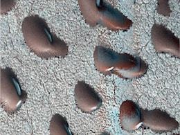
Mars Satellite Images Reveal Giant 'Kidney Beans,' Sparking Hints of Water and Life
- Thursday January 16, 2025
- Written by Gadgets 360 Staff
NASA's Mars Reconnaissance Orbiter captured images of frozen sand dunes in Mars' northern hemisphere, revealing unique formations halted by carbon dioxide frost during winter. Unlike Earth's desert dunes, which shift with wind, these Martian dunes remain stationary until spring thaw releases their icy grip. Scientists study these features to unders...
-
 www.gadgets360.com
-

Pixxel to Launch India’s First Private Satellite Network, Eyes $19 Billion Market
- Tuesday January 14, 2025
- Reuters
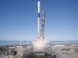
Pixxel is set to launch three of its six hyperspectral imaging satellites aboard a SpaceX rocket from California on Tuesday. The launch is scheduled to take place at the Vandenberg Space Force Base at around 10:45 a.m. Pacific Time (1845 GMT) on Tuesday - just after midnight the next day in India - subject to final approvals.
-
 www.gadgets360.com
-

Iran’s Folded Rocks Reveal Ancient Tectonic Power at Asia-Europe Boundary
- Monday April 21, 2025
- Written by Gadgets 360 Staff
Iran’s Zagros Mountains showcase tightly folded rock layers caused by the slow-motion collision of the Arabian and Eurasian plates. Visible from space, these dramatic geological structures reveal the raw power of continental tectonics and provide scientists with valuable insights into mountain formation, seismic activity, and Earth’s ongoing st...
-
 www.gadgets360.com
-

ISRO Satellite Images Show Damage After Earthquake Rattled Myanmar
- Tuesday April 1, 2025
- World News | Written by Pallava Bagla
The Indian Space Research Organisation (ISRO) has released satellite images of the widespread damages caused by the 7.7 magnitude earthquake that struck Myanmar and rattled neighbouring countries on Friday.
-
 www.ndtv.com
-

Myanmar Earthquake Aftermath: Satellite Images Show Huge-Scale Destruction
- Monday March 31, 2025
- World News | Edited by Sanstuti Nath
The stench of decaying dead bodies permeated the air in Mandalay-- Myanmar's second-largest city-- on Sunday, two days after a massive earthquake killed at least 1,700 people and left countless others buried.
-
 www.ndtv.com
-

Satellite Images Show Fresh Chinese Bomber Deployment In South China Sea
- Friday March 28, 2025
- World News | Reuters
China deployed two long-range H-6 bombers around the Scarborough Shoal this week, in Beijing's latest move to assert sovereignty over the hotly disputed atoll in the South China Sea, satellite images obtained by Reuters showed.
-
 www.ndtv.com
-

Rocket Lab Deploys Eight Satellites to Boost Global Wildfire Monitoring
- Monday March 31, 2025
- Written by Gadgets 360 Staff
Rocket Lab successfully launched eight satellites into orbit for OroraTech on March 26. The mission, "Finding Hot Wildfires Near You," aims to improve real-time wildfire detection through thermal infrared imaging. The satellites will join OroraTech’s existing network, operating at a 97-degree inclination, 550 km above Earth. CEO Martin Langer hig...
-
 www.gadgets360.com
-

Partial Solar Eclipse of March 2025: Satellite Images to Show Moon’s Shadow
- Saturday March 29, 2025
- Written by Gadgets 360 Staff
A partial solar eclipse will take place on March 29, 2025, visible across parts of Europe, Africa, and North America. The event will reach its peak in Nunavik, Canada, where 94% of the sun will be covered at sunrise. From space, weather satellites like GOES-16 and Himawari will capture images of the moon’s shadow. The International Space Station ...
-
 www.gadgets360.com
-

NASA’s EZIE Satellites Begin Mission to Study Auroral Electrojets and Space Weather
- Friday March 21, 2025
- Written by Gadgets 360 Staff
NASA’s Electrojet Zeeman Imaging Explorer (EZIE) mission has been launched aboard a SpaceX Falcon 9 from Vandenberg Space Force Base. The trio of small satellites will map auroral electrojets, powerful currents in Earth’s atmosphere linked to solar storms. Their data will enhance space weather prediction models and help understand planetary mag...
-
 www.gadgets360.com
-

Google Pixel 9a Design, Colour Options Spotted in Leaked Renders and Marketing Images
- Saturday March 8, 2025
- Written by David Delima
Google Pixel 9a is expected to launch soon, and tipster Evan Blass has shared design renders showcasing the smartphone in four colour options, along with marketing images highlighting its features. Recently spotted on certification websites, the Pixel 9a is expected to be the next midrange smartphone from Google, equipped with the Tensor G4 chip us...
-
 www.gadgets360.com
-

Mt Everest's Snow Cover Receded By 150 Metres This Winter, Show Satellite Images
- Thursday February 20, 2025
- World News | Press Trust of India
A 'rising snow line' -- in which snow melts at lower heights, forcing the snow line boundary up a mountainside -- is suggestive of a warming climate.
-
 www.ndtv.com
-

NASA’s PUNCH Mission Set to Track the Sun’s Corona and Solar Wind in 3D
- Friday February 7, 2025
- Written by Gadgets 360 Staff
NASA’s PUNCH mission, set for launch on Feb 27, will deploy four satellites to study the transition between the sun’s corona and the solar wind. The mission aims to improve understanding of space weather by capturing 3D images, helping predict solar storms with greater accuracy. The data will also complement NASA’s Parker Solar Probe, offerin...
-
 www.gadgets360.com
-

'Fireflies' Light Up Sky As India Gets 1st Private Satellite Constellation
- Wednesday January 15, 2025
- India News | Written by Pallava Bagla
A Bengaluru-based space startup has made history by giving India the first private earth imaging satellite constellation. The constellation -'Firefly' - has been developed by Pixxel.
-
 www.ndtv.com
-

Satellite Captures Svalbard Bear Island's Rare Cloud Formations and Algal Bloom
- Thursday January 16, 2025
- Written by Gadgets 360 Staff
A 2023 satellite image captured algal bloom and atmospheric vortices near Bear Island in Norway’s Svalbard archipelago. The algal bloom, stretching 400 kilometres, formed vibrant spirals due to ocean currents. Atmospheric vortices, caused by airflow disruption over Miseryfjellet mountain, mirrored these patterns in the sky. Bear Island’s radioa...
-
 www.gadgets360.com
-

SpaceX Successfully Launches 131 Satellites on Transporter 12 Mission
- Thursday January 16, 2025
- Written by Gadgets 360 Staff
SpaceX’s Transporter 12 mission, launched from Vandenberg Space Force Base, deployed 131 satellites into low Earth orbit on 14 January 2025. Among the payloads were 37 satellites from Planet Labs, including the AI-powered Pelican-2, designed for high-resolution imaging and real-time data analysis. The mission also saw the Falcon 9 booster success...
-
 www.gadgets360.com
-

Mars Satellite Images Reveal Giant 'Kidney Beans,' Sparking Hints of Water and Life
- Thursday January 16, 2025
- Written by Gadgets 360 Staff
NASA's Mars Reconnaissance Orbiter captured images of frozen sand dunes in Mars' northern hemisphere, revealing unique formations halted by carbon dioxide frost during winter. Unlike Earth's desert dunes, which shift with wind, these Martian dunes remain stationary until spring thaw releases their icy grip. Scientists study these features to unders...
-
 www.gadgets360.com
-

Pixxel to Launch India’s First Private Satellite Network, Eyes $19 Billion Market
- Tuesday January 14, 2025
- Reuters
Pixxel is set to launch three of its six hyperspectral imaging satellites aboard a SpaceX rocket from California on Tuesday. The launch is scheduled to take place at the Vandenberg Space Force Base at around 10:45 a.m. Pacific Time (1845 GMT) on Tuesday - just after midnight the next day in India - subject to final approvals.
-
 www.gadgets360.com

