Satellite Imagery
- All
- News
- Videos
-

Greenland’s Melting Glaciers Expose 1,620 km of New Coastline Since 2000
- Tuesday April 1, 2025
- Written by Gadgets 360 Staff
Over the past 20 years, Greenland’s glaciers have melted enough to expose 1,620 kilometres of new coastline, altering the Arctic’s geography. Satellite data from 2000 to 2020 tracked these changes, showing significant ice loss. The study also identified 35 newly exposed islands, some of which remain unclaimed on existing maps. Scientists warn o...
-
 www.gadgets360.com
-

3,000-Year-Old Mesopotamian Canal System Found in Iraq, Unveiling Ancient Irrigation Methods
- Monday March 10, 2025
- Written by Gadgets 360 Staff
A large network of ancient irrigation canals has been discovered in Iraq’s Eridu region, dating back over 3,000 years. The system, with over 200 major canals and 4,000 smaller ones, was used to divert Euphrates River water to farms. Researchers traced the canals using satellite imagery and geological mapping. The findings suggest the canals were ...
-
 www.gadgets360.com
-

Pixxel to Launch India’s First Private Satellite Network, Eyes $19 Billion Market
- Tuesday January 14, 2025
- Reuters
Pixxel is set to launch three of its six hyperspectral imaging satellites aboard a SpaceX rocket from California on Tuesday. The launch is scheduled to take place at the Vandenberg Space Force Base at around 10:45 a.m. Pacific Time (1845 GMT) on Tuesday - just after midnight the next day in India - subject to final approvals.
-
 www.gadgets360.com
-

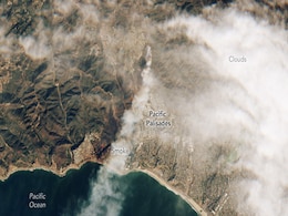
Satellite Images Reveal the Widespread Destruction of Los Angeles Fires from Space
- Tuesday January 14, 2025
- Written by Gadgets 360 Staff
Satellite images have captured the widespread destruction caused by the ongoing wildfires in Southern California, with over 34,000 acres burned. The Palisades Fire is the largest and most destructive, having devastated Malibu and other areas. Firefighters have successfully protected vital infrastructure like Mount Wilson Observatory and NASA's Jet ...
-
 www.gadgets360.com
-

Satellite Imagery Exposes Russia Smuggling Illicit Oil To North Korea
- Saturday November 23, 2024
- World News | Written by Anushree Jonko
Despite international efforts to sanction North Korea for developing weapons of mass destruction, the country continues to receive illicit supplies of refined petroleum products. These products are crucial for manufacturing weapons.
-
 www.ndtv.com
-

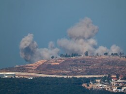
Satellite Images Show Lebanese Towns In Ruins After Israeli Bombing Campaign
- Tuesday October 29, 2024
- World News | Reuters
Israel's military campaign in southern Lebanon has caused vast destruction in more than a dozen border towns and villages, reducing many of them to clusters of grey craters, according to satellite imagery provided to Reuters by Planet Labs Inc.
-
 www.ndtv.com
-

Israeli Airstrikes In Iran Hit Its Missile Fuel-Mixing Facilities: Report
- Sunday October 27, 2024
- World News | Reuters
Commercial satellite imagery showed that Israeli airstrikes hit buildings during an attack on Saturday that Iran used for mixing solid fuel for ballistic missiles.
-
 www.ndtv.com
-

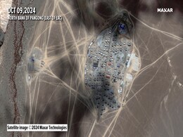
Satellite Pics: China's New Base Near Pangong Lake "Unlike Any Other Site"
- Monday October 14, 2024
- World News | Written by Vishnu Som
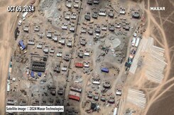
Senior Indian military sources who have analysed satellite imagery of a new Chinese base on the North bank of the Pangong Lake say that the site ''is unlike any other site'' that lies on the Chinese side of the Line of Actual control.
-
 www.ndtv.com
-

Satellite Images Expose Crater After Russia's Sarmat Missile Test Failure
- Monday September 23, 2024
- World News | Reuters
A Russian RS-28 Sarmat intercontinental ballistic missile likely failed during a test earlier this month, according to arms experts and satellite imagery from the launch site.
-
 www.ndtv.com
-

ESA Launches New Satellite with AI Tech to Study Earth Observation
- Tuesday August 20, 2024
- Gadgets 360 Staff
ESA’s Φsat-2 satellite was launched aboard a SpaceX Falcon 9 rocket from Vandenberg Space Force Base, marking a significant advancement in Earth observation technology. This cutting-edge CubeSat is designed to push the boundaries of how artificial intelligence can enhance space-based monitoring. Equipped with a state-of-the-art multispectral cam...
-
 www.gadgets360.com
-

Satellite Photos Show Iran Expanding Missile Production: Report
- Tuesday July 9, 2024
- World News | Reuters
Recent satellite imagery shows major expansions at two key Iranian ballistic missile facilities that two American researchers assessed are for boosting missile production, a conclusion confirmed by three senior Iranian officials.
-
 www.ndtv.com
-

China Counters India's Rafale With Stealth Jet Deployment Near Sikkim
- Friday May 31, 2024
- India News | Written by Vishnu Som
New, high resolution satellite imagery available with NDTV show several J-20s, China's most advanced stealth fighter, landing at a key high-altitude Tibetan air base located less than 150 kilometres from the Sikkim border.
-
 www.ndtv.com
-

Exclusive: End Of Opium Poppy Cultivation In Manipur Soon? Satellite Imagery Data Shows...
- Sunday April 14, 2024
- India News | Written by Debanish Achom
The total area of opium poppy cultivation in violence-hit Manipur has declined 60 per cent since 2021, latest data from the autonomous government institution Manipur Remote Sensing Applications Centre shows.
-
 www.ndtv.com
-

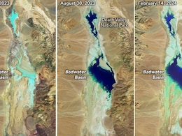
NASA Shares Before And After Satellite Pics Of Rare Lake In World's Hottest Place
- Sunday February 18, 2024
- Science | Edited by Ritu Singh
Satellite imagery from NASA captured the basin before the hurricane and after, and again following the recent rainstorm.
-
 www.ndtv.com
-

30% of Gaza Buildings Destroyed Or Damaged, Show Satellite Pics: UN Centre
- Friday February 2, 2024
- World News | Reuters
Satellite imagery analysed by the United Nations Satellite Centre shows that 30% of the Gaza Strip's buildings have been destroyed or damaged in the Israel offensive in the densely populated Palestinian enclave.
-
 www.ndtv.com
-

Greenland’s Melting Glaciers Expose 1,620 km of New Coastline Since 2000
- Tuesday April 1, 2025
- Written by Gadgets 360 Staff
Over the past 20 years, Greenland’s glaciers have melted enough to expose 1,620 kilometres of new coastline, altering the Arctic’s geography. Satellite data from 2000 to 2020 tracked these changes, showing significant ice loss. The study also identified 35 newly exposed islands, some of which remain unclaimed on existing maps. Scientists warn o...
-
 www.gadgets360.com
-

3,000-Year-Old Mesopotamian Canal System Found in Iraq, Unveiling Ancient Irrigation Methods
- Monday March 10, 2025
- Written by Gadgets 360 Staff
A large network of ancient irrigation canals has been discovered in Iraq’s Eridu region, dating back over 3,000 years. The system, with over 200 major canals and 4,000 smaller ones, was used to divert Euphrates River water to farms. Researchers traced the canals using satellite imagery and geological mapping. The findings suggest the canals were ...
-
 www.gadgets360.com
-

Pixxel to Launch India’s First Private Satellite Network, Eyes $19 Billion Market
- Tuesday January 14, 2025
- Reuters
Pixxel is set to launch three of its six hyperspectral imaging satellites aboard a SpaceX rocket from California on Tuesday. The launch is scheduled to take place at the Vandenberg Space Force Base at around 10:45 a.m. Pacific Time (1845 GMT) on Tuesday - just after midnight the next day in India - subject to final approvals.
-
 www.gadgets360.com
-

Satellite Images Reveal the Widespread Destruction of Los Angeles Fires from Space
- Tuesday January 14, 2025
- Written by Gadgets 360 Staff
Satellite images have captured the widespread destruction caused by the ongoing wildfires in Southern California, with over 34,000 acres burned. The Palisades Fire is the largest and most destructive, having devastated Malibu and other areas. Firefighters have successfully protected vital infrastructure like Mount Wilson Observatory and NASA's Jet ...
-
 www.gadgets360.com
-

Satellite Imagery Exposes Russia Smuggling Illicit Oil To North Korea
- Saturday November 23, 2024
- World News | Written by Anushree Jonko
Despite international efforts to sanction North Korea for developing weapons of mass destruction, the country continues to receive illicit supplies of refined petroleum products. These products are crucial for manufacturing weapons.
-
 www.ndtv.com
-

Satellite Images Show Lebanese Towns In Ruins After Israeli Bombing Campaign
- Tuesday October 29, 2024
- World News | Reuters
Israel's military campaign in southern Lebanon has caused vast destruction in more than a dozen border towns and villages, reducing many of them to clusters of grey craters, according to satellite imagery provided to Reuters by Planet Labs Inc.
-
 www.ndtv.com
-

Israeli Airstrikes In Iran Hit Its Missile Fuel-Mixing Facilities: Report
- Sunday October 27, 2024
- World News | Reuters
Commercial satellite imagery showed that Israeli airstrikes hit buildings during an attack on Saturday that Iran used for mixing solid fuel for ballistic missiles.
-
 www.ndtv.com
-

Satellite Pics: China's New Base Near Pangong Lake "Unlike Any Other Site"
- Monday October 14, 2024
- World News | Written by Vishnu Som
Senior Indian military sources who have analysed satellite imagery of a new Chinese base on the North bank of the Pangong Lake say that the site ''is unlike any other site'' that lies on the Chinese side of the Line of Actual control.
-
 www.ndtv.com
-

Satellite Images Expose Crater After Russia's Sarmat Missile Test Failure
- Monday September 23, 2024
- World News | Reuters
A Russian RS-28 Sarmat intercontinental ballistic missile likely failed during a test earlier this month, according to arms experts and satellite imagery from the launch site.
-
 www.ndtv.com
-

ESA Launches New Satellite with AI Tech to Study Earth Observation
- Tuesday August 20, 2024
- Gadgets 360 Staff
ESA’s Φsat-2 satellite was launched aboard a SpaceX Falcon 9 rocket from Vandenberg Space Force Base, marking a significant advancement in Earth observation technology. This cutting-edge CubeSat is designed to push the boundaries of how artificial intelligence can enhance space-based monitoring. Equipped with a state-of-the-art multispectral cam...
-
 www.gadgets360.com
-

Satellite Photos Show Iran Expanding Missile Production: Report
- Tuesday July 9, 2024
- World News | Reuters
Recent satellite imagery shows major expansions at two key Iranian ballistic missile facilities that two American researchers assessed are for boosting missile production, a conclusion confirmed by three senior Iranian officials.
-
 www.ndtv.com
-

China Counters India's Rafale With Stealth Jet Deployment Near Sikkim
- Friday May 31, 2024
- India News | Written by Vishnu Som
New, high resolution satellite imagery available with NDTV show several J-20s, China's most advanced stealth fighter, landing at a key high-altitude Tibetan air base located less than 150 kilometres from the Sikkim border.
-
 www.ndtv.com
-

Exclusive: End Of Opium Poppy Cultivation In Manipur Soon? Satellite Imagery Data Shows...
- Sunday April 14, 2024
- India News | Written by Debanish Achom
The total area of opium poppy cultivation in violence-hit Manipur has declined 60 per cent since 2021, latest data from the autonomous government institution Manipur Remote Sensing Applications Centre shows.
-
 www.ndtv.com
-

NASA Shares Before And After Satellite Pics Of Rare Lake In World's Hottest Place
- Sunday February 18, 2024
- Science | Edited by Ritu Singh
Satellite imagery from NASA captured the basin before the hurricane and after, and again following the recent rainstorm.
-
 www.ndtv.com
-

30% of Gaza Buildings Destroyed Or Damaged, Show Satellite Pics: UN Centre
- Friday February 2, 2024
- World News | Reuters
Satellite imagery analysed by the United Nations Satellite Centre shows that 30% of the Gaza Strip's buildings have been destroyed or damaged in the Israel offensive in the densely populated Palestinian enclave.
-
 www.ndtv.com


