Satellite Mapping
- All
- News
- Videos
-

NASA’s EZIE Satellites Begin Mission to Study Auroral Electrojets and Space Weather
- Friday March 21, 2025
- Written by Gadgets 360 Staff
NASA’s Electrojet Zeeman Imaging Explorer (EZIE) mission has been launched aboard a SpaceX Falcon 9 from Vandenberg Space Force Base. The trio of small satellites will map auroral electrojets, powerful currents in Earth’s atmosphere linked to solar storms. Their data will enhance space weather prediction models and help understand planetary mag...
-
 www.gadgets360.com
-

Pokemon Go Owner Niantic Sells Gaming Business to Saudi Group for $3.5 Billion
- Thursday March 13, 2025
- Matthew Martin, Bloomberg News
Scopely has agreed to buy Niantic’s gaming business. The Niantic games business generated more than $1 billion (roughly Rs. 8,702 crore) in revenue from 30 million monthly active users last year, Scopely said.
-
 www.gadgets360.com
-

NASA Launches Satellite On Mission To Detect Water On The Moon
- Thursday February 27, 2025
- Science | Reuters
Lunar Trailblazer, which weighs about 440 pounds (200 kg) and measures about 11.5 feet (3.5 meters) wide when its solar panels are fully deployed, is being sent to find and map this water on the moon's surface.
-
 www.ndtv.com
-

What "Hell" Looks Like: Satellite Pics Show Los Angeles Ravaged By Wildfire
- Friday January 10, 2025
- World News | Edited by Samiran Mishra
California's ongoing wildfire crisis has caused catastrophic destruction in Los Angeles County, as newly released satellite images from Maxar Technologies reveal the scale of the devastation brought about by the Palisades Fire and the Eaton Fire.
-
 www.ndtv.com
-

Ancient Bronze Age Settlement Discovered in Caucasus Mountains Using Drone Mapping
- Thursday January 9, 2025
- Written by Gadgets 360 Staff
In the Caucasus Mountains, drone mapping has uncovered Dmanisis Gora, an ancient settlement dating back over 3,000 years. The project, led by Dr. Nathaniel Erb-Satullo and Dimitri Jachvliani, employed drones to capture high-resolution images of the site, revealing a vast defensive wall, graves, and other structural remains. The discovery challenges...
-
 www.gadgets360.com
-

ISRO and NASA to Launch NISAR Satellite in March 2025 for Earth Observation
- Tuesday December 24, 2024
- Written by Gadgets 360 Staff
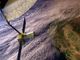
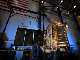
The ISRO-Nasa collaboration on the NISAR satellite will launch in March 2025, aiming to revolutionise global Earth observation. The satellite, featuring advanced radar technology, will monitor land and ice surfaces, track ecosystem changes, and detect geological events like earthquakes and landslides. The mission will help map Earth’s surface wit...
-
 www.gadgets360.com
-

Sea Turtles Can Aid Scientists Map Under-Ocean Seagrass in an Attempt to Conserve Marine Ecology
- Thursday November 28, 2024
- Written by Gadgets 360 Staff
A study in the Red Sea has shown that satellite-tagged green turtles can map seagrass meadows more accurately than conventional satellite imagery. By tracking 53 turtles, the researchers uncovered 34 new seagrass patches. This method not only overcomes the challenges of existing mapping technologies but also aids in conserving these vital ecosystem...
-
 www.gadgets360.com
-

NASA Disasters Programme Uses Artificial Intelligence to Help Aid Response Efforts
- Wednesday November 27, 2024
- Written by Gadgets 360 Staff
NASA is leveraging artificial intelligence and open science to enhance disaster preparedness, response, and recovery efforts. During events like Hurricane Ida, NASA provided actionable data on soil moisture, flood detection, and power outages through its Disasters Mapping Portal. AI-driven tools, like blue tarp detection for damaged roofs, are aidi...
-
 www.gadgets360.com
-

NASA’s Lunar Trailblazer Set to Explore Moon’s Water Cycle and Ice Locations
- Wednesday October 30, 2024
- Written by Gadgets 360 Staff
NASA’s upcoming Lunar Trailblazer mission aims to explore and map water on the Moon. Set for launch next year, this satellite will utilise advanced instruments to identify and measure water in various forms. It will investigate permanently shadowed craters and surface features to gather insights about lunar water's origins and its potential for f...
-
 www.gadgets360.com
-

Video Explainer: Understanding The LAC And The Stand-Off With China
- Thursday October 24, 2024
- World News | Reported by Vishnu Som, Written by Abhishek Chakraborty
PM Narendra Modi and Chinese President Xi Jinping held their first "formal bilateral meeting" since the military stand-off between India and China began in 2020. Here is an explainer with video, a map, and satellite images to help understand the LAC.
-
 www.ndtv.com
-

ISRO EOS-08 Satellite Begins Operations, Captures Thermal Images of Pune With EOIR Payload
- Monday September 23, 2024
- Written by Gadgets 360 Staff
The Indian Space Research Organisation (ISRO) recently announced the start of operations for its Electro Optical-Infrared (EOIR) payload placed inside the EOS-08 Earth Observation Satellite. The satellite was launched on the space agency's Small Satellite Launch Vehicle (SSLV) on August 16. The main goal of this mission is to improve India's therma...
-
 www.gadgets360.com
-
Sun Mission and Climate Satellite: ISRO's Launch Schedule After Chandrayaan-3 Moon Mission
- Tuesday August 22, 2023
- Press Trust of India
A mission to study the Sun, and launching a climate observation satellite, a test vehicle as part of the Gaganyaan human space flight program, and an Indo-US synthetic aperture radar -- ISRO has a packed schedule ahead.
-
 www.gadgets360.com
-

NISAR: 5 Points On NASA-ISRO Satellite That Can "Map All Of Earth In 12 Days"
- Friday July 14, 2023
- India News | Edited by Amit Chaturvedi
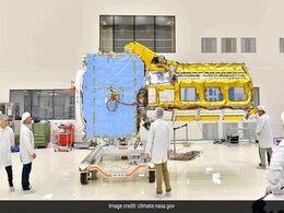
NISAR satellite, a joint project between India and the United States, reached a key milestone recently as its two components were integrated to form a single spacecraft in Bengaluru, American space agency NASA said on its website.
-
 www.ndtv.com
-

Goa To Rope In Satellite Imagery Firm To Identify Coastal Regulation Zone Violations
- Monday July 3, 2023
- Goa News | Press Trust of India
The Goa government will engage a company with expertise in satellite imagery to map structures that existed on the state's shoreline before 1991 to understand the extent of the Coastal Regulation Zone (CRZ) violations, a senior official said.
-
 www.ndtv.com
-

NISAR Earth Observation Satellite Handed Over by US Air Force to ISRO in Bengaluru
- Wednesday March 8, 2023
- ANI
NISAR, an earth observation satellite jointly developed by US space agency NASA and the Indian Space Research Organisation (ISRO) was handed over by the US Air Force to India on Wednesday. The satellite will be used by ISRO for a variety of purposes including agricultural mapping, and monitoring landslide-prone areas.
-
 www.gadgets360.com
-

NASA’s EZIE Satellites Begin Mission to Study Auroral Electrojets and Space Weather
- Friday March 21, 2025
- Written by Gadgets 360 Staff
NASA’s Electrojet Zeeman Imaging Explorer (EZIE) mission has been launched aboard a SpaceX Falcon 9 from Vandenberg Space Force Base. The trio of small satellites will map auroral electrojets, powerful currents in Earth’s atmosphere linked to solar storms. Their data will enhance space weather prediction models and help understand planetary mag...
-
 www.gadgets360.com
-

Pokemon Go Owner Niantic Sells Gaming Business to Saudi Group for $3.5 Billion
- Thursday March 13, 2025
- Matthew Martin, Bloomberg News
Scopely has agreed to buy Niantic’s gaming business. The Niantic games business generated more than $1 billion (roughly Rs. 8,702 crore) in revenue from 30 million monthly active users last year, Scopely said.
-
 www.gadgets360.com
-

NASA Launches Satellite On Mission To Detect Water On The Moon
- Thursday February 27, 2025
- Science | Reuters
Lunar Trailblazer, which weighs about 440 pounds (200 kg) and measures about 11.5 feet (3.5 meters) wide when its solar panels are fully deployed, is being sent to find and map this water on the moon's surface.
-
 www.ndtv.com
-

What "Hell" Looks Like: Satellite Pics Show Los Angeles Ravaged By Wildfire
- Friday January 10, 2025
- World News | Edited by Samiran Mishra
California's ongoing wildfire crisis has caused catastrophic destruction in Los Angeles County, as newly released satellite images from Maxar Technologies reveal the scale of the devastation brought about by the Palisades Fire and the Eaton Fire.
-
 www.ndtv.com
-

Ancient Bronze Age Settlement Discovered in Caucasus Mountains Using Drone Mapping
- Thursday January 9, 2025
- Written by Gadgets 360 Staff
In the Caucasus Mountains, drone mapping has uncovered Dmanisis Gora, an ancient settlement dating back over 3,000 years. The project, led by Dr. Nathaniel Erb-Satullo and Dimitri Jachvliani, employed drones to capture high-resolution images of the site, revealing a vast defensive wall, graves, and other structural remains. The discovery challenges...
-
 www.gadgets360.com
-

ISRO and NASA to Launch NISAR Satellite in March 2025 for Earth Observation
- Tuesday December 24, 2024
- Written by Gadgets 360 Staff
The ISRO-Nasa collaboration on the NISAR satellite will launch in March 2025, aiming to revolutionise global Earth observation. The satellite, featuring advanced radar technology, will monitor land and ice surfaces, track ecosystem changes, and detect geological events like earthquakes and landslides. The mission will help map Earth’s surface wit...
-
 www.gadgets360.com
-

Sea Turtles Can Aid Scientists Map Under-Ocean Seagrass in an Attempt to Conserve Marine Ecology
- Thursday November 28, 2024
- Written by Gadgets 360 Staff
A study in the Red Sea has shown that satellite-tagged green turtles can map seagrass meadows more accurately than conventional satellite imagery. By tracking 53 turtles, the researchers uncovered 34 new seagrass patches. This method not only overcomes the challenges of existing mapping technologies but also aids in conserving these vital ecosystem...
-
 www.gadgets360.com
-

NASA Disasters Programme Uses Artificial Intelligence to Help Aid Response Efforts
- Wednesday November 27, 2024
- Written by Gadgets 360 Staff
NASA is leveraging artificial intelligence and open science to enhance disaster preparedness, response, and recovery efforts. During events like Hurricane Ida, NASA provided actionable data on soil moisture, flood detection, and power outages through its Disasters Mapping Portal. AI-driven tools, like blue tarp detection for damaged roofs, are aidi...
-
 www.gadgets360.com
-

NASA’s Lunar Trailblazer Set to Explore Moon’s Water Cycle and Ice Locations
- Wednesday October 30, 2024
- Written by Gadgets 360 Staff
NASA’s upcoming Lunar Trailblazer mission aims to explore and map water on the Moon. Set for launch next year, this satellite will utilise advanced instruments to identify and measure water in various forms. It will investigate permanently shadowed craters and surface features to gather insights about lunar water's origins and its potential for f...
-
 www.gadgets360.com
-

Video Explainer: Understanding The LAC And The Stand-Off With China
- Thursday October 24, 2024
- World News | Reported by Vishnu Som, Written by Abhishek Chakraborty
PM Narendra Modi and Chinese President Xi Jinping held their first "formal bilateral meeting" since the military stand-off between India and China began in 2020. Here is an explainer with video, a map, and satellite images to help understand the LAC.
-
 www.ndtv.com
-

ISRO EOS-08 Satellite Begins Operations, Captures Thermal Images of Pune With EOIR Payload
- Monday September 23, 2024
- Written by Gadgets 360 Staff
The Indian Space Research Organisation (ISRO) recently announced the start of operations for its Electro Optical-Infrared (EOIR) payload placed inside the EOS-08 Earth Observation Satellite. The satellite was launched on the space agency's Small Satellite Launch Vehicle (SSLV) on August 16. The main goal of this mission is to improve India's therma...
-
 www.gadgets360.com
-
Sun Mission and Climate Satellite: ISRO's Launch Schedule After Chandrayaan-3 Moon Mission
- Tuesday August 22, 2023
- Press Trust of India
A mission to study the Sun, and launching a climate observation satellite, a test vehicle as part of the Gaganyaan human space flight program, and an Indo-US synthetic aperture radar -- ISRO has a packed schedule ahead.
-
 www.gadgets360.com
-

NISAR: 5 Points On NASA-ISRO Satellite That Can "Map All Of Earth In 12 Days"
- Friday July 14, 2023
- India News | Edited by Amit Chaturvedi
NISAR satellite, a joint project between India and the United States, reached a key milestone recently as its two components were integrated to form a single spacecraft in Bengaluru, American space agency NASA said on its website.
-
 www.ndtv.com
-

Goa To Rope In Satellite Imagery Firm To Identify Coastal Regulation Zone Violations
- Monday July 3, 2023
- Goa News | Press Trust of India
The Goa government will engage a company with expertise in satellite imagery to map structures that existed on the state's shoreline before 1991 to understand the extent of the Coastal Regulation Zone (CRZ) violations, a senior official said.
-
 www.ndtv.com
-

NISAR Earth Observation Satellite Handed Over by US Air Force to ISRO in Bengaluru
- Wednesday March 8, 2023
- ANI
NISAR, an earth observation satellite jointly developed by US space agency NASA and the Indian Space Research Organisation (ISRO) was handed over by the US Air Force to India on Wednesday. The satellite will be used by ISRO for a variety of purposes including agricultural mapping, and monitoring landslide-prone areas.
-
 www.gadgets360.com


