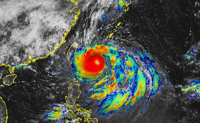
Super Typhoon Hinnamnor is now charging towards the islands of Japan, packing winds of upto 150 miles per hour (241 kilometres per hour). This is the strongest tropical cyclone so far this year, according to weather.com.
Here are 5 points on Super Typhoon Hinnamnor
It is expected to move east of Okinawa then to the south and turn to the north through the weekend. The wind speed is expected to come down as the typhoon moves forward, but they will still be very strong. Taipei and Shanghai are the two major cities, which will be affected by the cyclone's movement, weather.com further said. Souther parts of South Korea will also be affected along with some light impact on the Chinese coast.
A thunderstorm alert has been issued in several parts of Japan. AccuWeather said that these warning include life-threatening flooding, destructive wind gusts, storm surge, dangerous seas, disruptions to the energy and commerce sectors, violent winds and high waves.
Hinnamnor is the 11th tropical storm of 2022 that has developed into a typhoon. Meteorologist Dr Jake Carstens said on Twitter that it has "textbook traits" of strongest storms - "almost perfectly concentric eyewalls and self-induced erratic wobbling motion".
The typhoon is likely to become stationary over the seas near Okinawa on Friday and then move north to come closer again to the prefecture, according to NHK World.
Rainfall during the 24-hour-period through Thursday morning is expected to reach up to 150 millimetres in Hokkaido, 120 millimetres in Tohoku, 100 millimetres in Tokai, and 80 millimetres in the Kansai region.

